Montezuma


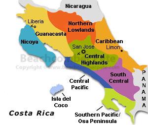
Located on the southern shore of the Nicoya Peninsula is the seaside village of Montezuma. The village has a carefree laid back atmosphere which has attracted many young foreigners over the years. Montezuma has been found to be a great place to chill and enjoy the quiet tranquil atmosphere, with many local flavored shops and restaurants adding to this bohemian lifestyle. Backpackers and eco tourist have found the rock strewn beaches, rivers as well as the scenic waterfalls make this a must see destination in Costa Rica.

Montezuma is not the place for tourist looking to be pampered at an all inclusive resort. With a laid back atmosphere Montezuma has attracted the young and budget minded crowds. Many small bed and breakfast places as well as hotels offer a wide range of inexpensive rooms. The village offers no bank or post office, one would need to travel to the city of Cobano , about a 20 min.. drive inland depending on road conditions. The village seems to come alive as the sun sets, with many locals, expats as well as tourist walking the streets of Montezuma checking out the many restaurants and bars, handicrafts or just sitting, relaxing and people watching.
Main street Montezuma, Nicoya Peninsula, Costa RicaMontezuma is known for its beaches and climbing cliffs abundant with tropical vegetation just seeming to flow into the warm waters of the Pacific. Many small coves with rock outcroppings make this beach lover’s heaven with small palm tree lined white sand beaches to the long open expanse of Playa Grande. A short 20 min walk out of town will bring you to the Cascades of Montezuma, adventurers and eco tourist will find the 3 falls of Cascade of Montezuma some of the best and scenic in Costa Rica. Large pools of fresh water can find many tourist and locals swimming and jumping from the rocks adjoining the falls.

A 30 minute walk north along the shore leaving the village of Montezuma one will find a river with a mystic rook garden at the entrance of a canyon leading to another waterfall. Another 10 minutes up the coast will bring you to Playa Grande, a long palm tree lined beach sitting along the Nicolas Wesberg Absolute Reserve. Playa Grande is also a favorite among surfers and boogie boarders. For the more adventures, a 2 hour hike north along the coast will take you to El Chorro, a pictures waterfall just tumbling into the Pacific Ocean. Zip line tours as well as day trips for snorkeling and scuba diving on Tortuga Island can be arranged with one of the vendors in Montezuma. A 20 minute drive south from the village one will find the entrance to the Cabo Blanco Absolute Nature Reserve.


Reaching Montezuma by car one will need to take the ferry from Puntarenas to Parquera then to the city of Cabano and then Montezuma. If one wishes to fly there is the small airport in Tambor with daily flights to San Jose. A visit to Montezuma is definitely worth the trip

Carara National Park


 A haven to hikers and birdwatchers, Carara National Park offers an amazing diversity of fauna and flora that any nature-lover will appreciate. Nestled along the Central Pacific Coast of beautiful Costa Rica, the park was established as a biological reserve in 1978. Due to its increased popularity, it was upgraded to national park status in 1998.

Bring Your Binoculars

Travelers from around the world venture to Carara National Park in hopes of seeing one of the few Scarlet Macaws left in existence. The part protects one of the last wild colonies as there are said to be around 150 of these gorgeous birds that can be seen at dusk as they head to the coastal mangroves to roost at night.

Scarlet Macaw, Carara National Park, Costa RicaThere are also more than 400 other species to be spotted in this delicate ecosystem. Other birds that enthusiasts are always delighted to spot include the Collared Forest-falcon, Boat-billed heron, Mangrove Black-hawk and the endemic Mangrove hummingbird.

Wildlife

You don’t have to be a bird-lover to enjoy spotting other wildlife at Carara National Park. Crocodiles can be found along the river in abundance which you have a good chance of seeing up close if you take one of the park’s touring boat rides.

The collection of forests, lagoons and marshlands attract an array of wildlife. Hiking on one of the two trails through the park may grant you photo opportunities of monkeys, armadillos, boas, jaguars, Margay cats, white-tailed deer, opossums, tayra, kinkajou and more.

Marvel at the Flora

Carara National Park offers one of the world’s most diverse tree collections. Tall species can be found, draped in creeping vines and epiphytes. Then, when the dry season arrives, the land transforms into a blanket of brilliant yellow flowers.

Getting Here

Carara National Park is in a fairly central location with Jaco about 15 miles south and San Jose roughly 30 miles to the east. You can take a bus from either location but you need to make lodging locations near the park or be prepared to take the last bus back as no camping is permitted on the grounds.

If you are driving in from San Jose, you will follow Avenida 10 to Highway 27. Take this west 34 miles until you reach the town of Orotina. Continue 3 miles and turn left on Highway 34. Follow this scenic, coastal highway 11 miles to the Tarcoles River. Cross the bridge and you are at the boundary of the park. The ranger station can be found 1.8 miles into the park.


Considerations

The forests of Carara National Park are hot and humid, even in the drier season. Regardless when you visit, be prepared for mosquitoes and other biting insects. Long sleeves and pants as well as a quality repellant are strongly recommended to ensure that you enjoy your visit without being bothered by pests.

Juan Castro National Park


Juan Castro National Park Situated in the Arenal Huetar Norte Conservation Area of Costa Rica, this national park has naturalized cloud forest and rainforest regions. Its beautiful, natural attractions as well as its colorful birds and amazing wildlife are worth a trek even if there are no public facilities. Walking paths do cross the forests to the main sites, and exploring park is an exciting eco-adventure.

Directions to the Park

To the west of the park’s main entrance is found Ciudad, Quesada. Taking the highway southeast, San Jose is about 75 kilometres from Ciudad Quesada.

Juan Castro Blanco National Park, Costa RicaArenal Huetar Norte Conservation Area

The area set aside by the government that takes up most of northern Costa Rica. The land is divided into wildlife refuges, forest conservation areas and Juan Castro National Park. Parts of the conservation areas also contain vast wetlands.

Natural Features of Juan Castro National Park

The park has two volcanoes. Porvenir is a dormant volcano, but Platanar is active. The park’s highest point above sea level is 2,270 metres. Hot springs and lovely waterfalls are found along the river system. Exquisite orchids are everywhere throughout the mixed forests that include yayo, landswoods and a variety of oaks. About half of the forests are cloud and the other portion is rainforest. Those who like to go trekking and enjoy nature photography will be happy to explore all the amazing sites of nature in this Costa Rican national park.

Wildlife

Birds – Over two hundred and thirty bird species have been found in the park, a phenomenal number. One of the best activities for the park is bird watching. Those that bring binoculars and cameras with telescopic lenses may be able to capture spectacular birds.

Mammals – Fifty-seven different species have been recorded within this national park. This collection of animals includes over twenty species of bats. Other animals are common to the region like sloths, ocelots and howler monkeys.

Endangered Wildlife

Here are four endangered creatures found in Juan Castro National Park:


Black Guan and Curasow – These large birds live in trees in the subtropical highland forest. They are loud birds with a distinctive voices and calls according to species.

Red Brocket Deer – Small deer that live in the deep jungle forests of the park. They only stand about 70 centimetres tall.

Quetzal – Brightly colored birds in the highlands of the cloud forests, the quetzals’ height measures about 32 centimeters.

South Central


South of San Jose and the Central Highlands one will find the South Central Region of Costa Rica. When visitors think of Costa Rica, the country has long had a reputation among travelers as a paradise. Its natural beauty includes tropical beaches fronting on two oceans, rainforests, volcanoes, and even alpine plateau. Adventurers will find a broad range of satisfying activities and treks, sun worshipers will encounter a climate second to none in the hemisphere, and naturalists will have the opportunity to investigate thousands of unique species of flora and fauna.

La Amistad International Park , Costa RicaResearch is invaluable, especially in targeting the best season for enjoying the right activity, and also with an eye to value. Costa Rica is not as inexpensive as its neighbors, especially in the “dry” season from November to April, and clever planning is recommended in order to avoid overpaying for accommodations. Both transportation and health are issues deserving serious attention. Certain regions are prone to flooding, for instance, and roads may not be as reliable as expected for some itineraries. Vaccinations for tropical travel are also an issue that foreigners will need to confront early on.

Most travelers will fly into San Jose, and since all roads in the country radiate out from the capital it is likely that a short stay there is inevitable. A package may eliminate the need for further inquiry, but if you are going it alone this will be a useful period to collect guidance for all your final destination goals.

Our focus is on the South Central Region, dominated by La Amistad International Park and the Talamanca Range, capped to the west by the Chirippo Massif at the apex of the Continental Divide. Both can be reached by some of the best roads in the country, and most destinations are within a few hours’ drive or bus trip south from the capital. Both, if relatively close to centers of population, are more noted for ecotourism than for traditional luxury.

The first concern for travel here is altitude; most are surprised by how cold it can get, especially along the Cordillera, with many peaks well over 3000 meters. Warm clothing and protection against extremes of moisture and wind are definitely necessary. And though only a few volcanoes are active, it pays to keep abreast of current conditions.


Amistad hosts a number of stunning ecosystems, including the famous alpine Cloud Forests. The name is also literal, as these old growth oaks to the Caribbean and Pacific sides of the ridge are frequently shrouded in heavy mists. Hiking is recommended for the hardy, whether with a group or solo. Be aware that ranger stations are only found to the Pacific side. Other sights include geothermal vents, geysers, and pools, volcanoes in eruption, coffee plantations at slightly lower altitude, and some of the best tropical and subalpine bird watching in the world.

Direct encounters are the theme, and the ultimate among them is the tallest peak in the country. Cerro Chirippo stands at 3820 m (12,533 feet!), and an adventurous few among Costa Rica’s 1.5 million visitors do attempt a summit.

This and more awaits in South Central Costa Rica.

Irazu Volcano National Park


Irazu Volcano National Park in Costa Rica, offers visitors a unique chance to see a live volcano. Just 38 miles from San Jose and driving over good roads, makes the park a perfect day trip. Established in August of 1955, the 5,705 acres of Irazu Volcano National Park is home to Irazu Volcano, the tallest volcano in Costa Rica, which towers over the land at a height of 11,260 feet (3,432 meters).

The most spectacular of the volcano’s multiple craters is Diego de la Haya. Visitors come to view this 300 feet deep crater because of its mineral lake that has the ability to change color from a deep emerald green to striking crimson red. The color change is caused by the minerals that are present in the crate lake.

Irazu Volcano National Park, Costa RicaThe last activity of the Irazu Volcano was recorded in 1996 and the last eruption occurred in 1963. The park is located in the higher elevations above the frost line and in some places above the tree line. The higher elevation, which is usually above the clouds, brings chilly temperatures that are near freezing at the rim of the volcano. Visitors to Irazu are warned to prepare for cold wind and freezing temperatures, but the danger of sunburn still exists because of the areas proximity to the Equator, where the sun in more intense.

Tourists to the Irazu Volcano National Park can take the half mile hiking trail path, which winds between the multiple craters of the Irazu Volcano, and loops around giving hikers a closer look at the pyroclastic cone and each crater.

Indigenous wildlife that makes this rugged volcanic terrain their home includes the Volcano Junco, Volcano Hummingbird, Agouti, Armadillo, Coati, and Spiny Green Lizards. There is a great opportunity to see a Three Wattled Bellbird or even a Chestnut Mandibled Toucan when hiking in the park. The lower elevation of the volcano is rich in vegetation which supports indigenous squirrels, rabbits, coyotes, foxes, owls and birds like robins and woodpeckers.


The Irazu Volcano National Park has a small Visitor Center where visitors can learn about how a volcano functions and about the local wildlife of the Irazu Volcano. Inside the park, visitors will find public restrooms, tourist information, drinking water, and a gift shop. After hiking in the park, visitors can get a meal at the park snack bar and eat at nearby picnic tables.

Orosi


 The words “beautiful valley” describe the town of Orosi Costa Rica . Orosi is situated in a valley that is considered to be the most beautiful in the whole country. Orosi offers breathtaking views and swaying pine trees that are covered with Spanish moss. Orosi, Costa Rica is known for its peaceful and tranquil settings and is a pleasure to nature lovers. Beautiful hot springs, amazing waterfalls, rich soil, and the perfect climate are all enjoyed in Orosi.

Orosi is located 18 miles from San Jose and 7 miles from Cartago. The small town of Orosi has a population of a little over 4,600. Orosi is a well-preserved colonial area that has made it through numerous earthquakes over the years. This town was named after a Huetar Indian chief who lived in the area; Orosi was later colonized by the Spanish.

Orosi Valley, Orosi, Costa RicaThe production of coffee is the leading industry in the area of Orosi. Beautiful coffee plantations and private farms such as Chucaras Hotsprings Estate are places where tourists can learn about the production of coffee and enjoy Hot Springs swimming pools. The thermal baths of Los Balnearious and Los Patios offer relaxation and comfort to visitors and residents alike.

Rain forests, volcanoes, valleys, and hills with sugar cane and coffee plants are all part of the Orosi region. Orosi is rich in history and has monuments dating back many years ago. A colonial capital founded in 1563 and archeological excavations that date back to 1000 B.C are part of Orosi’s history.


Boating, fishing, mountain viewing, bird and wildlife watching, and shopping are all popular activities in Orosi. A much-visited attraction in Orosi is Tapanti National Park. Lake Cachi is popular for boating and fishing, while the Rio Reventazon is a great location for white-water rafting.

Important landmarks in Orosi include the oldest church being used in Costa Rica, the Ingelsia de San Jose Orosi. This church was built in 1734. Inside of the church is an altar carved from wood and decorated with religious paintings; the roof of the church is made from roofing cane and ceramic tile. Near the church is a museum that displays some of Costa Rica’s old religious artifacts that are Spanish-influenced.

Northern Lowlands


Costa Rica’s Northern Lowlands, heading north out of San Jose and leaving the Central Highlands behind, one enters an area that most consider the most spectacular region of Costa Rica. Bordered to the south by the volcanic mountain range of the Cordillera Central and descending into the lowlands northward to the Nicaragua border , the area offers a wide variety of land and vegetation diversity to be found anywhere in Costa Rica, thus making the Northern Lowlands, one of Costa Rica’s most popular travel destinations.

The Northern Lowlands is comprised of two main mountain ranges to the south, the Cordillera Central to the south and the Tilaran Mountain range to the to the Southwest, to the northwest separating the Northern Lowlands from the Guanacaste region lies the Cordillera de Guanacaste with all three mountain ranges providing the region with volcanoes and cloud forests. The base of the three mountain ranges gives way to two main plains extending northward to Nicaragua, to the west lies the Llanuras de los Guastusos plain and to the east the Llanura de San Carlos plain, taking in the Costa Rican provinces of Alajuela and Heredia.

Northern Lowlands Costa RicaToday, the Northern Lowlands are a popular tourist and adventure traveler destination, yet the area was mainly inaccessible until the late 50’s when Highway 126 was constructed connecting San Jose to the northern city of Puerto Viejo de Sarapiqui .

Sample Exploration Northern Lowlands copyTwo of the main draws to the area for travelers as well as nature lovers are the Arenal Volcano, one of the world’s 10 most active volcanoes, and the Monteverde Cloud Forest, a humid, cloudy and misty region that has become a favorite of nature lovers drawn to its high biodiversity.

Cloud forests and volcanoes are not the only draws to the region; the Northern Lowlands is also home to Lake Arenal, a large reservoir built to provide the countries electric needs has become a destination in itself for windsurfing enthusiasts as well as for the scenery surrounding the lake and its spectacular backdrop of Arenal Volcano on the lakes eastern shore. Some of Costa Rica’s premier rafting is found in the region on the Sarapiqui River. Waterfalls, hot springs, nature trails and horseback riding through out many of the areas nature parks provide a variety of opportunities for all travelers.  Cano Negro Nature Reserve is a must see when visiting the region


Costa Rica  sees a mixture of varying climates, from the cloud forest the climate is more humid and misty year round with temperatures in the high 60’s to low 70’s, descending into the plains the climate is more hot and humid, with a more pronounced dry season to the west towards the Pacific and less as you head east towards the Caribbean. The regions rainy season ranges from December to March and the dry season starts in April extending into November. If travelling to the area for the sole purpose of seeing Arenal Volcano, the best time of the year for unobstructed views is towards the end of the dry season during the months of September and October.

Alajuela

Alajuela, Costa Rica has the honor of being the country’s second most profound city. It’s ideally located within miles of the San Jose capital and several other important areas. Due to its perfect location in Central Highlands, the city attracts many who come to explore its rich history and culture.The city sits comfortably nestled in the Valley surrounded by coffee plantations and farmland. Visitors undoubtedly notice these vast landscapes as they travel by bus from the Santamaria International Airport to their hostel or hotel accommodations. Travelers can even see the city’s numerous cattle on their drive, its other means of trade.

Church, Alajuela, Costa RicaWith a population just over 46,000 Alajuela tends to be full of life. Visitors may experience numerous festivals, parties and other celebrations while visiting the city. The national holiday Juan Santamaria Day provides food, dancing and parades to the locals and visitors alike. This holiday celebrates Costa Rica’s national hero Juan Santamaria.

Alajuela’s history is greatly influenced by one important thing: its freedom. The city’s independence from Spain encouraged it to overcome adversity and turmoil. It was also Alajuela’s very own hero, Juan Santamaria that put the city on the world’s map. With his bravery and determination, the city defeated its adversaries at the Hacienda Santa Rosa. Since these tumultuous times, Alajuela has become a popular tourist attraction in Costa Rica.

Visiting the city’s surrounding areas is possible through day trips. These trips typically take travelers to Poas Volcano Park, the butterfly farm and several unique locales. Those who love coffee may take trips to the Doka Estate for coffee plantation tours. Staying within the city’s boundaries is also ideal. Travelers may choose to frequent Alajuela’s central park where they mingle with the locals. Here is where they people watch or munch on sweet treats from the many vendors who sell their wares.

The weather in Alajuela is temperate all-year round with temperatures reaching the high 80s in the summer and low 60s or 70s in the cooler months. The city’s tropical weather greatly influences the success of its crops and farmland. Most consider Alajuela’s weather to be perfectly suitable for agricultural growth.

San José


San Jose, called Chepe by locals, is Costa Rica’s hub. It is not only the capital, but the economic and cultural center as well. Nearly one third of the country’s population lives in or near San Jose, and even more in nearby cities. Many visitors use San Jose as a gateway to the country’s natural wonders, since the urban area is only a short drive from the geological and biological attractions that draw many visitors to Costa Rica. The unique ecosystems of the mountaintop cloud forests are only a day trip away. So is Irazu Volcano National Park, with its eerie moonscape extending above the cloud cover. Manuel Antonio National Park with its gorgeous beaches and its four species of monkeys is only about eighty miles from the capital.

City View of San Jose Costa RicaBefore Europeans came to the Americas two great empires dominated the hemisphere. The intersection of the cultural influence of Aztecs and Incas lay in what is now the nation of Costa Rica, just north of the Isthmus of Panama. The country remains urbane and cosmopolitan even today. Costa Rica is the oldest democracy in the region. It abolished its standing army in the middle of the twentieth century and today hosts the headquarters of the Inter-American Court of Human Rights. The capital, San Jose, hosts a large expatriate community, and short term tourists flock to the city for its natural beauty, cultural opportunities and delightful entertainment.
Possibly the most distinctive attraction in San Jose is the Museum of Precolumbian Gold located in an underground structure beneath the Plaza de la Cultura. For a more modern take on precious metals, visit the Coin Museum in the same building. The most extensive collection of American jade in the world is housed in the Jade Museum. History buffs will be fascinated by the National Museum, and art lovers will appreciate the Museum of Costa Rican Art and the Museum of Contemporary Art. For a more unusual but equally fascinating display, check out the Museum of Criminology.

After the indoor attractions many visitors choose to enjoy Parque la Sabana, a reclaimed airport with trails, an artificial lake and an assortment of playing fields. Others seek out the shopping venues of Barrio Amon or the Avenida Central. Many of San Jose’s best restaurants are conveniently located in these same neighborhoods. After dark locals and visitors alike enjoy the El Pueblo entertainment complex or the dance floors of Los Yoses or San Pedro.


Costa Rica is located deep in the tropics, less than ten degrees of latitude from the equator, but San Jose’s 1000 meter elevation and the prevalence of mountain breezes means its temperature is mild enough to enjoy the whole year round, although from May until November the Costa Rica weather is quite rainy. At any time of year a few days spent in Chepe make a great vacation and a priceless introduction to the real Costa Rica.